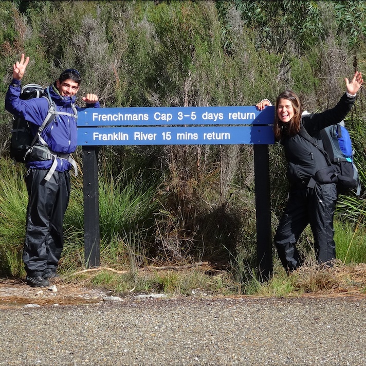
 10 days after I left Lilydale, I meet Eliane in Hobart after Easter holidays. Together we have planned to go to Frenchmans Cap, one of the hardest and most rewarding bushwalk in Tasmania located in the Franklin Gordon Wild Rivers National Park, Southwest of Tasmania.
The car park from where the track to Frenchmans Cap starts is 45minutes drive from Lake St Clair in the direction of the eastern side of the state.
However we left from Hobart with the bus company Tassielink. This one operates every Thursdays and Sundays and includes in its services a ticket to Frenchmans Cap for $55,70 one-way. That’s expensive, so we decided to come back from Frenchmans Cap to Hobart by hitchhiking with one of the bushwalkers met during our journey. We want to do the return walk to Frenchmans Cap in four days in order to be able to catch the bus to Hobart Sunday if any bushwalkers can take us.
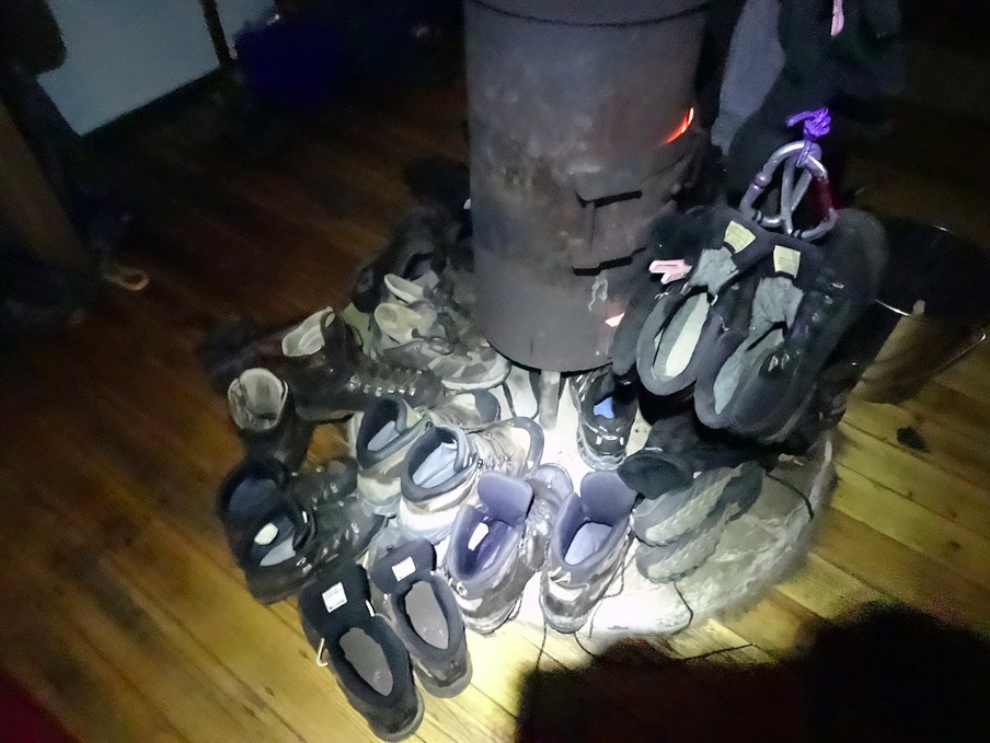
Usually, it takes three to five days to achieve the walk to Frenchmans Cap and at this time of the year, four seasons in one day are highly expected. Also, this loop has the reputation to be very muddy and wet. We won’t keep our shoes dry very long.
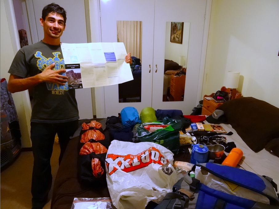
 With Eliane we don’t have our full equipment for this 45km long trek (return). However we are both lucky. When I arrived to Hobart three days before Frenchmans Cap, I stayed with Quinn (a warmshowers member). He landed to me a lot of his equipment; only a cooking pot and warm gloves and a tent are missing. I will get these ones thanks to Eliane’s relatives. Scott, Wendy’s son (our host before and after our walk to Frenchmans Cap), will land to us the last gears missing. Thanks to the generosity of the people we have met along our way (and who know us for less than 24h) we don’t need to rent any gear for Frenchmans Cap. That’s excellent! Now we only have to worry about shopping for these four days self-sufficient in the wilderness.
.
 The first day is maybe the less enjoyable. The track leading to Vera Hut is slippery and muddy and swampy (Loddon Plains have a bad reputation). As expected, we got four seasons in one day and these ones were changing every ten minutes! It’s really common in autumn. This first day walk is also the longest with 16km between Frenchmans Cap car park and Lake Vera Hut. However the Rangers are making many nice boardwalks above the wetlands. Without their efforts, we could have mud up to the belt in Loddon plains, seriously. The footpath allows us to walk quite fast except in some muddy areas without man’s construction. We left Frenchmans Cap car park at 12:45 to arrive ten minutes before the sunset to Lake Vera Hut with the picture of the Orange Loddon River in our mind.

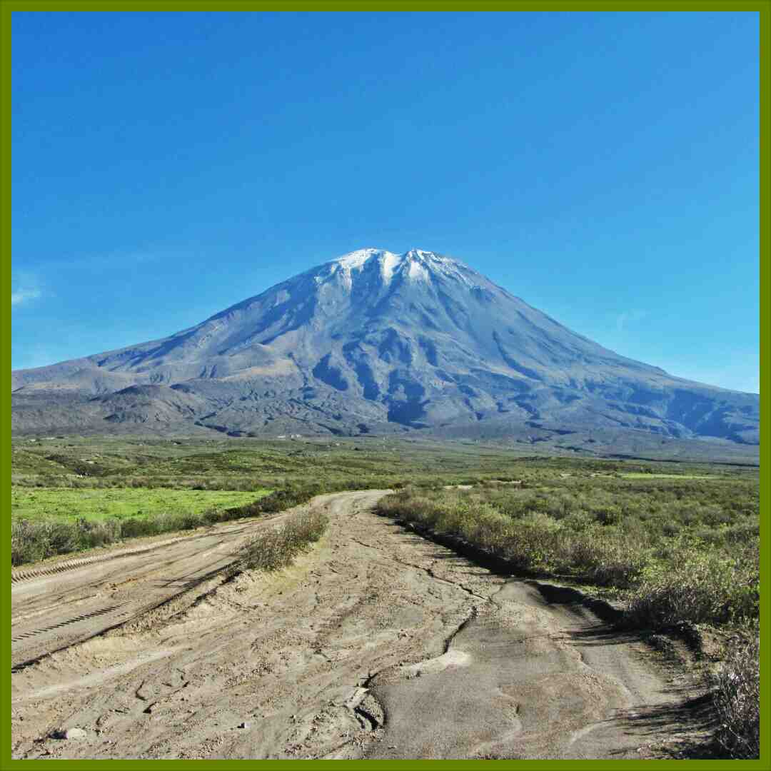
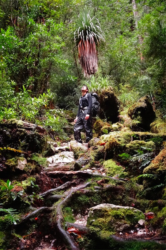 The second day was my favourite. It took us three hours to reach Lake Tahune Hut from Lake Vera. It’s also this day we will reach the summit of Frencmans Cap with an exceptionally clear sky in the afternoon. The climb to Barron Pass is a little bit tough but the beauty surrounding you and the discreet rangers constructions will live down your pain. From the top of Barron Pass you did half way of your walk to Lake Tahune Hut. Through the natural gate formed by The White Needle and Nicoles Needle you’ll see it, Frenchmans Cap, dominating the place from its 1446m high constituted of white quartzite and its impressive 300 meters which are the stuff of dreams for many rock climbers and base-jumpers all around the world. The next part of the track goes on boulders along Sharlands Peak range. Then, the path goes on a plateau that provides an exceptional view to the northeast side of the National Park. However this one is really exposed to the gusts
  of wind.
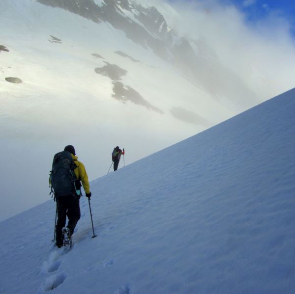
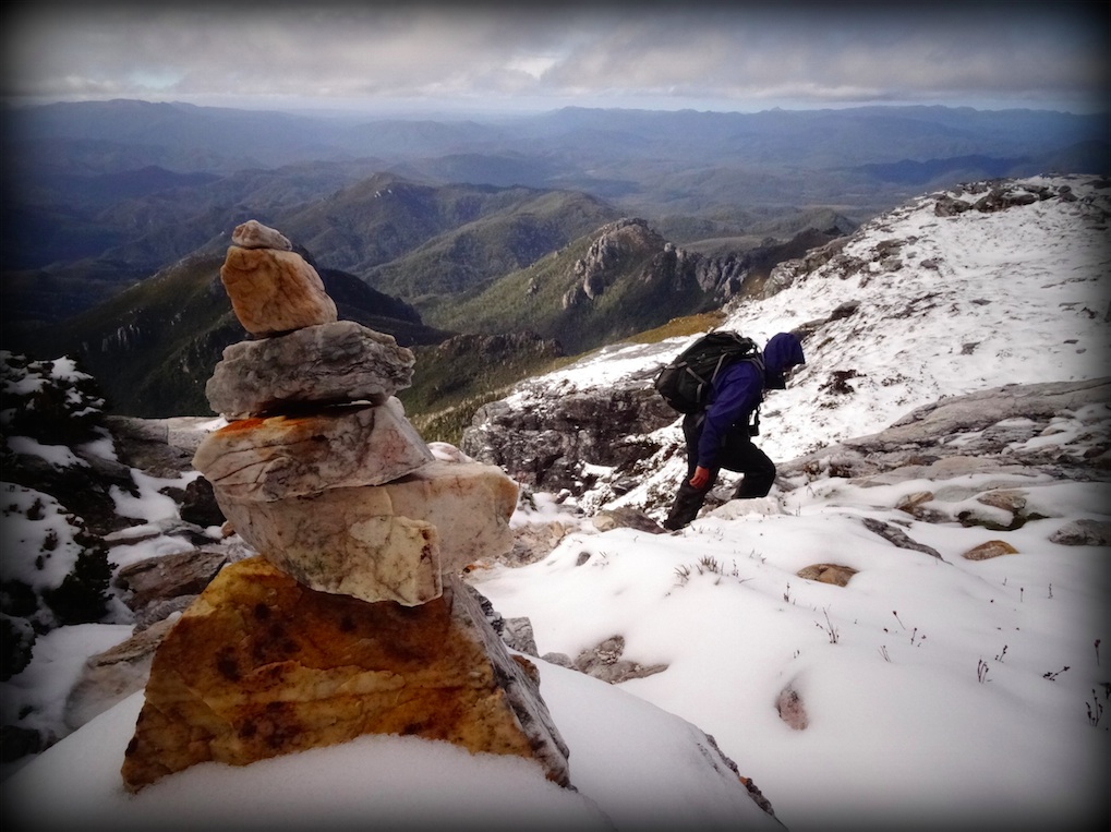
From Lake Tahune Hut the summit of Frenchmans Cap is only 1.5km away. We leave the hut right after lunch with a clear sky. Along our way up we’ll discover the beauty of Lake Tahune, a pool encircled by orange colour in the middle of green mountains. The second half of the walk is more technical with several “rock climbing” sections before to walk in snow (for the second time in Australia!). 1h30 after we left Lake Tahune hut we reach the summit of Frenchmans Cap and enjoy the 360° view. There are no human signs for kilometres and the closest town is Strahan (1000 inhabitants) 38km as the crow flies, hidden by a mountain range. The low clouds moving quickly limit the visibility beyond. We’ll start our way back down to Lake Tahune Hut hut after 30 minutes of admiration.
.
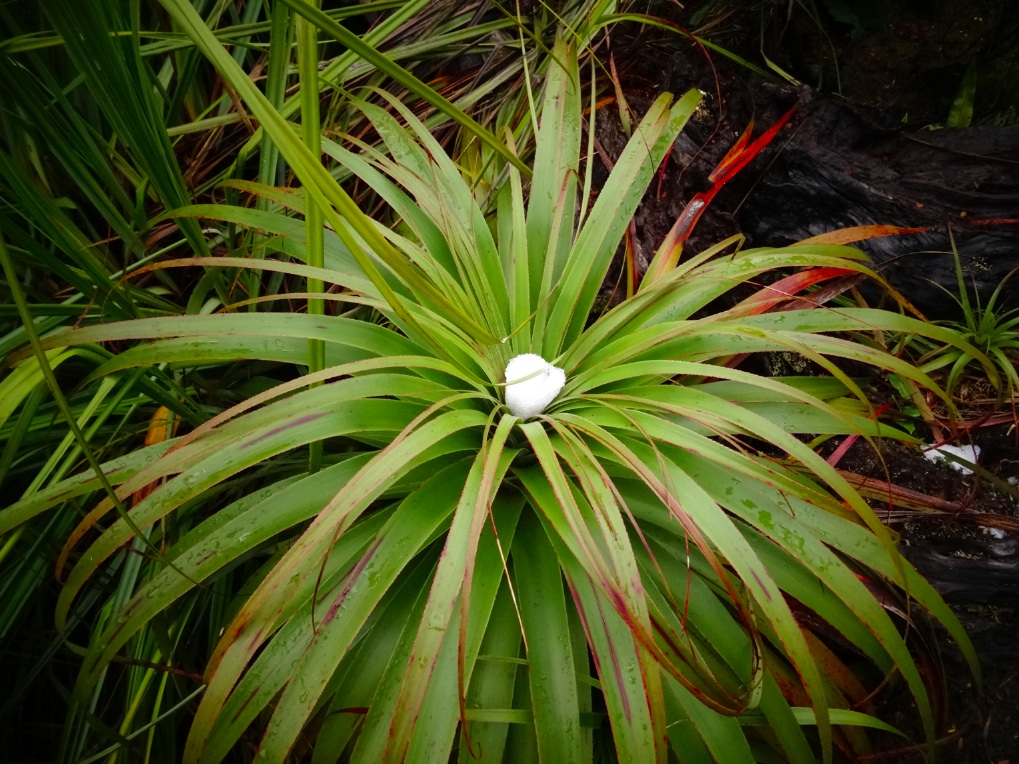 It rained all night long. However our third day walk is quite short to Lake Vera Hut. We will leave at 10AM spending half morning playing YATZY. It’s snowing, hailing, raining. The most difficult part remaining the plateau we crossed the day before receiving hails in our face and loosing our balance under the gusts of wind. The way down from Barron Pass comes with a lot of water maintaining our feet completely wet. This track is now a stream of water rising up the flow of the river. It’s funny to see the palm trees and menferns covered with snow but it’s hard to look around us. This section of track is really slippery and we can only look at our feet and stay focus on each step forward.
We will spend our afternoon playing RAMY and RATZY inside Lake Vera Hut in a dry and warm area while we get to know every present bushwalkers. Later in the afternoon we will meet Ben and his friends who we’ll take us from Frenchmans Cap car park to Hobart the next day.
I’m glad to get warm again and especially dry!
.

.
 [map style=”width: 340px; height:228px; margin:20px 0px 20px 0px; border: 1px solid black;” maptype=”TERRAIN” kml=”http://worldtour-outdoorexperience.com/wp-content/uploads/2014-04-24_27_Frenchmans-Cap_track.kml”]